Greenway Home | History | Get Involved | Projects | Plants and Animals
History
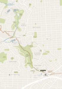 The Glen Park Greenway closely follows the old bed of one branch of Islais Creek The name of the creek is derived from the word “slay” or “islay,” the word used by the indigenous peoples (Yelamu Ramaytush Ohlone) for the hollyleaf cherries (Prunus ilicifolia) that lined the banks of the creek. Historically, Islais Creek comprised the largest watershed in Yerba Buena (renamed San Francisco in 1847), draining an area of nearly 5,000 acres. From its original sources, one in Glen Canyon and the other near the intersection of Cayuga Avenue and Regent Street, the creek flowed about 3.5 miles (5.6 km) to San Francisco Bay. Before it was in-filled, Islais Creek terminated in a bog that was approximately two miles (3.2 km) wide, located south of Potrero Hill in today’s Bayview and Hunters Point Districts. In the 19th century, Islais Creek provided as much as 85% of the drinking water in San Francisco, serving a large number of neighborhoods, such as Glen Park, Bernal Heights, Hunters Point, Visitacion Valley and parts of the Mission and Potrero Hill.
The Gold Rush of 1849 caused the population of San Francisco to grow from a small village in 1847 to a bustling city by 1849, just two years later. The population increased from only 200 residents (1846) to 36,000 people (1852) to 150,000 (1857), an increase over 11 years of 74,900%. from 500 to 150,000 between 1847 and 1870. This surge led to unprecedented development in retail, shipping, entertainment, lodging and transportation, as well as boarding houses, food preparation, sewing and laundry. All were highly profitable businesses that inevitably took a toll on the natural environment. For example, in 1871, the area along Islais Creek became known as the city’s “New Butchertown” when more than 100 slaughterhouses opened. The creek literally became a dumping place of garbage, sewage, animal waste and unsold meat products. Its condition became so bad that the creek was commonly referred to as “Shit Creek” by San Franciscans.
 After the 1906 Earthquake, Islais Creek almost completely disappeared when the City of San Francisco diverted much of the creek into underground culverts that it covered with debris from fallen buildings. For most of its length, the modern creek is contained by the City’s combined sewer and stormwater system so it now flows invisibly beside and under The Greenway.
In the middle of the 20th Century, Glen Park suffered another environmental assault. The city purchased and razed nearly 20 structures along the north side of Bosworth Street as part of its plan to build a Crosstown Freeway. Fortunately, this misguided plan to connect Interstate 280 with the Golden Gate Bridge through Glen Canyon Park was halted in the 1960s by neighborhood activists: Zoanne Theriault Nordstrom, Joan Seiwald, and Geri Arkush. These young women were deprecatingly called the “Gum Tree Girls” by the officials in charge of the freeway project. The activists proudly adopted that name and their successful campaign against the freeway is now commemorated in the name of a trail in Glen Canyon Park.
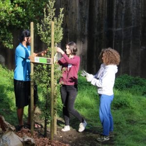
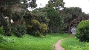
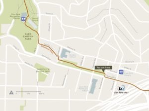
Today, the land along the Glen Park Greenway corridor is owned primarily by the San Francisco Department of Public Works (SFDPW) and the San Francisco Public Utilities Commission (SFPUC). Additionally, The Archdiocese of San Francisco owns a portion near St. John School. Most of these parcels are remainders of the property acquired by the City for the Crosstown Freeway. After the Crosstown Freeway plan was thwarted, the City planted trees on the undeveloped land. Unfortunately, due to a lack of funds, the city stopped tending the area early in the 21st Century, and it became seriously overgrown. Undeterred, walkers and hikers gradually created a trail through the vegetation, establishing a shortcut between Glen Park Village and Glen Canyon Park.
In 2012, after about a decade of work with the Glen Park Association (GPA), and in concert with interested residents, the Board of Supervisors approved the Glen Park Community Plan. This plan included, as one of its key objectives, improvement of the unmaintained land as an open space corridor and pedestrian path connecting Glen Park’s retail village and transit hub to Glen Canyon Park. Once the Greenway Concept Plan was envisioned in 2011, the GPA sponsored it as part of the SFDPW’s Street Park program, allowing the community to share responsibility for the stewardship of the public land. After obtaining Street Park status for the Greenway, GPA transferred the entire program to the San Francisco Parks Alliance (SFPA) to be operated as a project called Friends of the Glen Park Greenway. The mission of SFPA is to engage with communities to champion, transform and activate public spaces. Friends of the Glen Park Greenway is managed by an Executive Group composed of Glen Park residents.
The Greenway links a growing system of nature trails in the Bay Area: the Creeks to Peaks Trail, which connects to the iconic summits of Twin Peaks; and the Crosstown Trail, which connects Candlestick Point (SE San Francisco) to Lands End (NW San Francisco). The Greenway is also considered a spur of the Bay Area Ridge Trail, connecting at Twin Peaks.
Thanks to the generosity and labor of many in the community, this sylvan retreat is enjoyed today by walkers and runners and hosts a variety of local wildlife.
